
Ever stood at a rural bus stop with absolutely no idea when the next bus will arrive? Maybe the digital display is broken. Maybe there never was one. You’re stuck checking your phone, hoping some app knows better than the faded paper timetable taped to the pole. I built BusTable because I’ve been that person too many times.
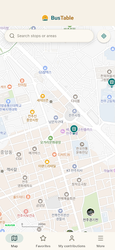
I started working on this because South Korea’s bus network is massive and wonderfully distributed—but coverage gaps were real. The big transit apps work great in Seoul and major cities, but venture into suburbs or rural areas and you hit a wall. Real-time data exists for some stops, but many smaller towns and village routes are completely invisible. I wanted to create something that didn’t ignore those gaps; instead, it turned them into an opportunity for a community to help each other.
The result is BusTable: a nationwide bus map that combines official real-time data where it exists, and fills the rest with photos of actual timetables shared by riders. It’s hyper-local transit intelligence built by people who actually use these stops.
What BusTable Does
- Map every stop in Korea — Pan the map and nearby bus stops appear instantly. Find stops near your location, your hometown, or wherever you’re traveling.
- Show real-time arrivals — Tap any stop to see which buses are coming, how many minutes away they are, and full route details (where real-time data is available).
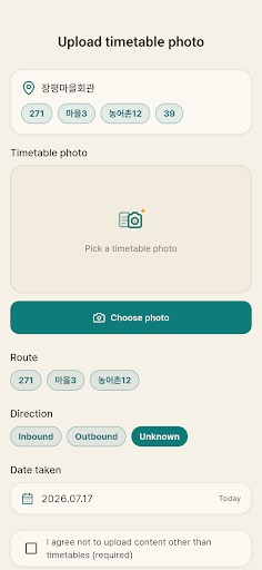
- Share paper timetable photos — Can’t find real-time data? Snap a photo of the printed timetable posted at the stop and upload it. Other riders at that stop will see it immediately.
- Community verification — Timetable photos are rated with likes and dislikes. Outdated or incorrect photos sink; reliable, current ones rise to the top.
- Local tips and reports — Leave comments on stops like “schedule changed last month” or “no service weekends.” Real, helpful intel from real riders.
- Earn contribution points — Level up every time you upload a photo, rate a timetable, or leave a report. Your contribution becomes someone else’s ride home.
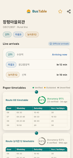
You don’t need an account to browse the map and check arrival times. Sign in only when you want to contribute photos or help verify timetables. It’s designed to be helpful whether you’re a casual browser or an active contributor.
Who This Is For
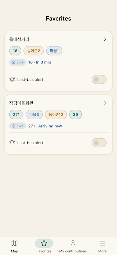
BusTable is built for Korea’s bus riders, especially those who depend on stops that don’t have real-time displays. If you’re catching a village bus that runs only a few times a day, living in suburban areas, or helping elderly relatives navigate unfamiliar routes, this app fills a real need. Travelers exploring Korea by public transit will find it invaluable. And if you just care about building better local transit information together with your neighbors, you’ll find a community doing exactly that.
Real-time data comes from Korea’s Ministry of Land, Infrastructure and Transport and the Seoul Metropolitan Government open data APIs. Timetable photos and comments are entirely community-contributed. Because this combines both official and user data, accuracy isn’t guaranteed—always double-check before time-critical trips.
BusTable is now live on Google Play. If you’re in Korea and tired of guessing when the next bus arrives, download it and see what your local bus stops look like when riders share timetable photos. Questions or suggestions? I’d love to hear from you at siwooeo@gmail.com.
Play Store에서 다운로드: BusTable: Bus Timetables & Map
Official page: reactiveworks.dev/apps/bustable
Update history: ahngo13.github.io
Leave a Reply